La Lucania vista e raccontata in varie lingue straniere
Testo in Inglese
Lucania was an ancient district of southern Italy, extending from the Tyrrhenian Sea to the Gulf of Taranto. To the north it adjoined Campania, Samnium and Apulia, and to the south it was separated by a narrow isthmus from the district of Bruttium. It thus comprised almost all the modern region of the Basilicata, with the greater part of the province of Salerno (the so-called Cilento) and a portion of that of Cosenza. The precise limits were the river Silarus on the north-west, which separated it from Campania, and the Bradanus, which flows into the Gulf of Tarentum, on the north-east; while the two little rivers Laus and Crathis, flowing from the ridge of the Apennines to the sea on the west and east, marked the limits of the district on the side of the Bruttii.
Almost the whole is occupied by the Apennines, here an irregular group of lofty masses. The main ridge approaches the western sea, and is continued from the lofty knot of mountains on the frontiers of Samnium, nearly due south to within a few miles of the Gulf of Policastro, and thenceforward is separated from the sea by only a narrow interval until it enters the district of the Bruttii. Just within the frontier of Lucania rises Monte Pollino, 7,325 ft (2,233 m), the highest peak in the southern Apennines. The mountains descend by a much more gradual slope to the coastal plain of the Gulf of Tarentum. Thus the rivers which flow to the Tyrrhenian Sea are of little importance compared with those that descend towards the Gulf of Tarentum. Of these the most important are the Bradanus (Bradano), the Casuentus (Basento), the Aciris (Agri), and the Siris (Sinni). The Crathis, which forms at its mouth the southern limit of the province, belongs almost wholly to the territory of the Bruttii, but it receives a tributary, the Sybaris (Coscile), from the mountains of Lucania. The only considerable stream on the western side is the Silarus (Sele), which constitutes the northern boundary, and has two important tributaries in the Calor (Calore Lucano or Calore Salernitano) and the Tanager (Tanagro or Negro) which joins it from the south.
Origin of the name: There are several hypotheses on the origin of the name Lucania, inhabited by Lucani, an Osco-Samnite population from central Italy. Lucania might be derived from Greek λευκός, leukos meaning "white", cognate of Latin lux ("light"). According to another hypothesis, Lucania might be derived from Latin word lucus meaning "sacred wood" (cognate of lucere), or from Greek λύκος, lykos meaning "wolf".
The district of Lucania was so called from the people bearing the name Lucani (Lucanians) by whom it was conquered about the middle of the 5th century BC. Before that period it was included under the general name of Oenotria, which was applied by the Greeks to the southernmost portion of Italy. The mountainous interior was occupied by the tribes known as Oenotrians and Choni, while the coasts on both sides were occupied by powerful Greek colonies which doubtless exercised a protectorate over the interior (see Magna Graecia). The Lucanians were a southern branch of the Samnite or Sabellic race, who spoke the Oscan language. They had a democratic constitution save in time of war, when a dictator was chosen from among the regular magistrates. A few Oscan inscriptions survive, mostly in Greek characters, from the 4th or 3rd century BC, and some coins with Oscan legends of the 3rd century. The Lucanians gradually conquered the whole country (with the exception of the Greek towns on the coast) from the borders of Samnium and Campania to the southern extremity of Italy. Subsequently the inhabitants of the peninsula, now known as Calabria, broke into insurrection, and under the name of Bruttians established their independence, after which the Lucanians became confined within the limits already described. After this we find them engaged in hostilities with the Tarentines, and with Alexander, king of Epirus, who was called in by that people to their assistance, 334 BC. In 298 BC (Livy x. II seq.) they made alliance with Rome, and Roman influence was extended by the colonies of Venusia (291 BC), Paestum (273), and above all Tarentum (272). Subsequently they were sometimes in alliance, but more frequently engaged in hostilities, during the Samnite wars. On the landing of Pyrrhus in Italy (281 BC) they were among the first to declare in his favor, and found themselves exposed to the resentment of Rome when the departure of Pyrrhus left his allies at the mercy of the Romans. After several campaigns they were reduced to subjection (272 BC). Notwithstanding this they espoused the cause of Hannibal during the Second Punic War (216 BC), and their territory during several campaigns was ravaged by both armies. The country never recovered from these disasters, and under the Roman government fell into decay, to which the Social War, in which the Lucanians took part with the Samnites against Rome (90-88 BC) gave the finishing stroke. In the time of Strabo the Greek cities on the coast had fallen into insignificance, and owing to the decrease of population and cultivation the malaria began to obtain the upper hand. The few towns of the interior were of no importance. A large part of the province was given up to pasture, and the mountains were covered with forests, which abounded in wild boars, bears and wolves. There were some fifteen independent communities, but none of great importance.
For administrative purposes under the Roman empire, Lucania was always united with the district of the Bruttii, a practice continued by Theodoric. The two together constituted the third region of Augustus.
The towns on the east coast were Metapontum, a few miles south of the Bradanus; Heraclea, at the mouth of the Aciris; and Sins, on the river of the same name. Close to its southern frontier stood Sybaris, which was destroyed in 510 BC, but subsequently replaced by Thurii. On the west coast stood Posidonia, known under the Roman government as Paestum; below that came Elea (Velia under the Romans), Pyxus, called by the Romans Buxentum, and Laüs, near the frontier of the province towards Bruttium. Of the towns of the interior the most considerable was Potentia, still called Potenza. To the north, near the frontier of Apulia, was Bantia (Aceruntia belonged more properly to Apulia); while due south from Potentia was Grumentum, and still farther in that direction were Nerulum and Muranum. In the upland valley of the Tanagrus were Atina, Forum Popilii and Consilinum (near Sala Consilina); Eburi (Eboli) and Volceii (Buccino), though to the north of the Silarus, were also included in Lucania. The Via Popilia traversed the district from N. to S., entering it at the NW. extremity; the Via Herculia, coming southwards from the Via Appia and passing through Potentia and Grumentum, joined the Via Popilia near the S.W edge of the district: while another nameless road followed the east coast and other roads of less importance ran W. from Potentia to the Via Popilia, N.E. to the Via Appia and E. from Grumentum to the coast at Heraclea. (T. As.)
The modern name Basilicata originates from the 10th century AD, when the area was under Byzantine control. The region was renamed and divided into Eastern and Western Lucania (Lucania Orientale and Lucania Ocidentale) for a short period of time during the Carbonari revolution of 1820-21, and from the latter half of the 19th century there was campaigning to reinstate the name. The change was made in 1932, in accordance with the fascist regime's appropriation of symbols from the Roman Empire, and was thus undone shortly after the war, in 1947. Lucania is still in vernacular use as a synonym to Basilicata.
BASILIKATA - (Testo in tedesco, text in deutscher sprache)
Basilikata oder Lukanien, Fläche 9'992 km2, Einwohner ca. 650'000.
Lukanien (lateinisch und italienisch: Lucania) ist eine historische Landschaft im Süden Italiens.
Benannt wurde die Landschaft im 3. Jahrhundert v. Chr. nach dem italischen (oskischen) Volk der Lukaner.
Lukanien war umgeben vom Tyrrhenischen Meer im Westen, dem Golf von Tarent im Osten, den Landschaften Campania, Samnium und Apulia im Norden sowie der Landschaft Bruttium, dem heutigen Kalabrien, im Süden.
Die Grenze gegen Campania verlief am Fluss Sele (lateinisch: Silarus), sodass der Großteil der heutigen kampanischen Provinz Salerno, insbesondere die Landschaft Cilento, zu Lukanien gehörte. Nordostwärts reichte Lukanien bis zum Fluss Bradanus.
Das Gebiet deckt sich somit im Kern mit der heutigen Region Basilicata.
Als regionale Benennung bekam „Lucania“ im Hochmittelalter, nach der Normannischen Eroberung Süditaliens, Konkurrenz durch „Basilicata“, den Namen einer Verwaltungseinheit, aus der die heutige Region Basilicata hervorging.
Basilikata leitet sich so vom byzantzinischen „basilikos“ ab, was im 9. und 10. Jahrhundert eine Bezeichnung für die dortigen Provinzfürsten war.
Basilikata umfasst die Provinzen Potenza und Matera mit der Bezirkshauptstadt Potenza. Die Bevölkerungsdichte ist sehr gering; die Menschen leben hauptsächlich in den Bergdörfern der Apenninen.
Die Region „an der Stiefelsohle Italiens“ zählt mit 10.848 Hektar Rebfläche zu den kleinsten Italiens. Der Weinbau lässt sich bis zu den Phöniziern zurückverfolgen. Die Römer nannten damals das Land Lucania und dieser Name ist neben Basilikata auch heute gebräuchlich.
Das etwas trostlose, gebirgige Hochland besteht in erster Linie aus Sedimentgestein (Lehm, Kalkstein und Sandstein) und wird von zahlreichen Wasserläufen durchflossen.
Die Weingärten sind in unzählige oft nicht einmal eine Hektar grosse Lagen zersplittert. Der grösste Teil liegt im Osten bei Matera in Flusstälern und in der Küstenebene des Ionischen Meeres um Metaponto.
Die Rebsorten und Weine der Basilikata:
im 6. Jahrhundert v. Chr. pflanzten die Griechen hier den Vorfahren der heute dominierenden roten Rebsorte Aglianico an, weitere wichtige rote Sorten sind Aleatico, Bombino Nero, Ciliegiolo, Malvasia Nera und Sangiovese. Die wichtigsten weissen Sorten sind Asprinio, Bombino Bianco, Fiano, Moscato Bianco und Trebbiano.
Die einzige DOC-Zone ist Aglianico del Vulture im äussersten Norden der Region an der Grenze zu Kampanien. Aglianico ist die dominierende Rebsorte und zeigt unterschiedliche Ausprägungen, von jungen, fruchtbetonten Rotweinen bis zum vecchio, der mindestens drei Jahre reifen muss. Der Produktions-Anteil der DOC-Zone macht nur etwa vier Prozent aus. Relativ jung sind die beiden IGT-Marken Grottino di Roccanova und Lucania.
Die Region Basilikata im Süden Italiens ist für ihren edlen Wein und ihre Berglandschaft vulkanischen Ursprungs bekannt.Mit seiner charakteristischen Silhouette überragt der Monte Vulture die Hügellandschaft im Nordwesten. Nach Westen ist der Krater des erloschenen Vulkans aufgebrochen und umschließt zwei Seen, die Laghi di Monticchio. Die Gegend rund um den Vulkan bietet ideale Anbaubedingungen für den mit dem DOC Prädikat ausgezeichneten Wein Aglianico de Vulture. Der Vino Aglianico gilt als einer der besten Rotweine Italiens. Weiter nördlich liegt die Städte Melfi und Matera. Melfi ist bekannt für sein Kastell, Matera für seine Altstadt, die zum Großteil aus Höhlensiedlungen, den sogenannten Sassi, besteht. 1993 wurden die Sassi zum Unesco Weltkulturerbe ernannt. Matera diente bereits als Kulisse für mehr als 30 Filme.
Basilicate - (Testo in francese)
La région de Basilicate (en italien : Regione Basilicata, anciennement Lucanie, nom officiel qu’elle posséda de 1932 à 1947), dite plus couramment la Basilicate, est une région d'Italie méridionale de 600 000 habitants dont le chef-lieu est Potenza. Elle comprend deux provinces : la province de Potenza et la province de Matera. Son nom provient du grec basilikos, qui signifie « royal ».
La Basilicate est une région enclavée, malgré deux façades maritimes au sud-est sur la mer Ionienne et à l'ouest sur la mer Tyrrhénienne, située entre les régions de Pouille, Campanie et Calabre. Mais à part une plaine maraichère à l'est (Métaponte), la région est avant tout montagneuse (Apennins de Lucanie), et caractérisée par des sols calcaires pauvres (plateau des Murge) ainsi qu'un climat méditerranéen très sec en été. La région présente également les seules zones désertiques d'Europe.
Faisant partie de la Grande-Grèce et peuplée par des colonies grecques côtières (dont la fameuse Σύβαρις Sybaris), elle fut conquise par Rome, et fit partie, avec la Calabre voisine, de la région du Bruttium. Les Romains finirent par distinguer cette région qu'il baptisèrent la Lucanie (du nom du peuple italique des Lucanii) de la Calabre.
Elle tomba ensuite aux mains des Byzantins, puis des Normands vers l'an 1000 avec la famille des Hauteville (Altavilla en italien). Leur présence explique la persistance d'enclaves linguistiques du gallo-italique de Basilicate, des parlers influencés par les parlers gallo-italiques. Après l'épisode normand, succédèrent les maisons d'Anjou, puis d'Aragon.
La Basilicate fut longtemps une région reculée et miséreuse. Sous le fascisme, les opposants politiques y étaient envoyés en exil, comme Carlo Levi, auteur du Christ s'est arrêté à Eboli. Récemment, la région s'est développée, et est d'ailleurs plus prospère que la plupart des autres régions du Mezzogiorno. Cela s'explique en partie par une bonne gestion des fonds structurels européens.
La Basilicate est divisée en deux provinces :
province de Matera,
province de Potenza.
Zu Tisch in der Basilicata - (Deutsch - Video in lingua tedesca)- Tursi, Documentario della televisione tedesca - 2002
Süditaliens Vulkanlandschaft Basilikata - (Deutsch - Video in lingua tedesca)
Die Region Basilikata im Süden Italiens ist für ihren edlen Wein und ihre Berglandschaft vulkanischen Ursprungs bekannt.Mit seiner charakteristischen Silhouette überragt der Monte Vulture die Hügellandschaft im Nordwesten. Nach Westen ist der Krater des erloschenen Vulkans aufgebrochen und umschließt zwei Seen, die Laghi di Monticchio. Die Gegend rund um den Vulkan bietet ideale Anbaubedingungen für den mit dem DOC Prädikat ausgezeichneten Wein Aglianico de Vulture. Der Vino Aglianico gilt als einer der besten Rotweine Italiens. Weiter nördlich liegt die Städte Melfi und Matera. Melfi ist bekannt für sein Kastell, Matera für seine Altstadt, die zum Großteil aus Höhlensiedlungen, den sogenannten Sassi, besteht. 1993 wurden die Sassi zum Unesco Weltkulturerbe ernannt. Matera diente bereits als Kulisse für mehr als 30 Filme.
Basilikata - (Deutsch - Video in lingua tedesca)
Die Region Basilikata im Süden Italiens galt lange als das Armenhaus des Landes. Den Besucher hingegen überrascht sie mit kulturellem Reichtum, einem Weltwunder und Vulkanwein.
Basilicata 2 - (Video in lingua inglese)
Basilicata autentica - (English - Video in lingua inglese)
Sono solo tre minuti. Tre minuti per far capire a tutti cosa è la Basilicata. Una Basilicata che si racconta attraverso le immagini di un Dvd Basilicata autentica che riprende la Regione dall'alto.
Una Basilicata che si lascia raccontare da un testimonial d'eccezione: il registra Francis Ford Coppola, fortemente legato alla regione lucana e soprattutto a Bernalda, paese d'origine del nonno di Coppola.
"Basilicata autentica" , raccontata in video dal grande regista Francis Ford Coppola, è realizzato con la regia di Michele Russo che racconta la saga della famiglia Coppola, originaria di Bernalda.
La musica che accompagna " Basilicata autentica" è una ballata , " Morrison's Jig" eseguita dalla musicista materana Giuliana De Donno.
("Basilicata autentica", narrated by the great video director Francis Ford Coppola, is made under the direction of Michele Russo which tells the saga of the Coppola family, originally from Bernalda.
The music that accompanies "Basilicata autentica" is a ballad, "Morrison's Jig" performed by materan woman musician Giuliana De Donno).
This is the italian sothern region called Basilicata or Lucania, both the same. It has about 590,000 inhabitants on a 10,000 square meters surface
Carluccio's Southern Italian Feast Basilicata - (English - Video in lingua inglese)
From the original Carluccio's Southern Italian Feast - episode 6 Calabria and Basilicata. Antonio Carluccio visits Basilicata, attends an ancient tradition of a treewedding and cooks some delicious meals from the region.
Documentario storico: Craco, vita e colori di un tempo che fu...
Raccolta di filmati storici del 1929, 1958, 1960, 1963, 1967, 1980 e 1991 - (English - Video in lingua inglese)
Quando si sente nominare Craco si pensa subito a questo paese della Lucania disabitato e con ruderi in abbandono. Il paese e' divenuto famoso sopratutto per le scene del film "Cristo si e' fermato a Eboli", che per la maggior parte e' stato filmato a Craco. Non si conoscevano finora scene di vita reale quando questo paesino era popolato di gente. Il primo filmato risale al 1929 ed e' uno tra i piu' vecchi filmati girati in Lucania, se non forse proprio il piu' vecchio filmato che si conosca sulla storia di questa regione. Il filmato precede di pochi anni la presenza di Carlo Levi in Lucania, quindi e' una importante testimonianza della vita in quel tempo. Probabilmente i filmati sono stati girati da oriundi lucani emigrati in America, dove sono stati scoperti e uniti in un unico Video. Anche la maggior parte dei sottofondi musicali rappresentano un importante archivio sonoro dell' allegra musica popolare lucana.
L' artista che si vede nel finale del video, dove disegna e racconta Craco e' Jeffrey Becom.
Jeffrey Becom è un artista visivo americano nato nel 1953. Jeffrey Becom ha esposto in diverse gallerie e musei, tra cui alla Verve Gallery of Photography.
(Jeffrey Becom is an American visual artist who was born in 1953. Jeffrey Becom has had several gallery and museum exhibitions, including at the Verve Gallery of Photography.)
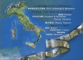
Matera - Italy - Unesco World Heritage Site - (English - Video in lingua inglese)
Matera About this sound listen is a town and a province in the region of Basilicata, in southern Italy. It is the capital of the province of Matera.Apart from an economy which has traditionally been based on agriculture, in the late 1990s the major economic base of Matera, and of surrounding cities, is the production of upholstered furniture. The town lies athwart a small canyon, which has been eroded in the course of years by a small stream, the Gravina.
Dreaming It{aly} from Matthew Brown (Basilicata) - (English - Video in lingua inglese). La mia terra, vista con gli occhi di uno straniero: questa è la Mia Basilicata!
ARGENTINA: Familia Basilicata Rosario en Colectividades 2011. La Familia Basilicata de Rosario a pleno en el escenario mayor del 27º Encuentro y Fiesta Nacional de Colectividades 2011. Nota en EncuentroDeColectividades.com, Rosarinos.com, Nuevaregion.com por gabriel Gómez Fiori. Agradecimiento a ETUR y Asociación de Colectividades Extranjeras de Rosario. - (Video in lingua spagnola)
Marsico Nuovo - I GOT SOUL - Chakal (cantante del Venezuela) - (Video in lingua spagnola)